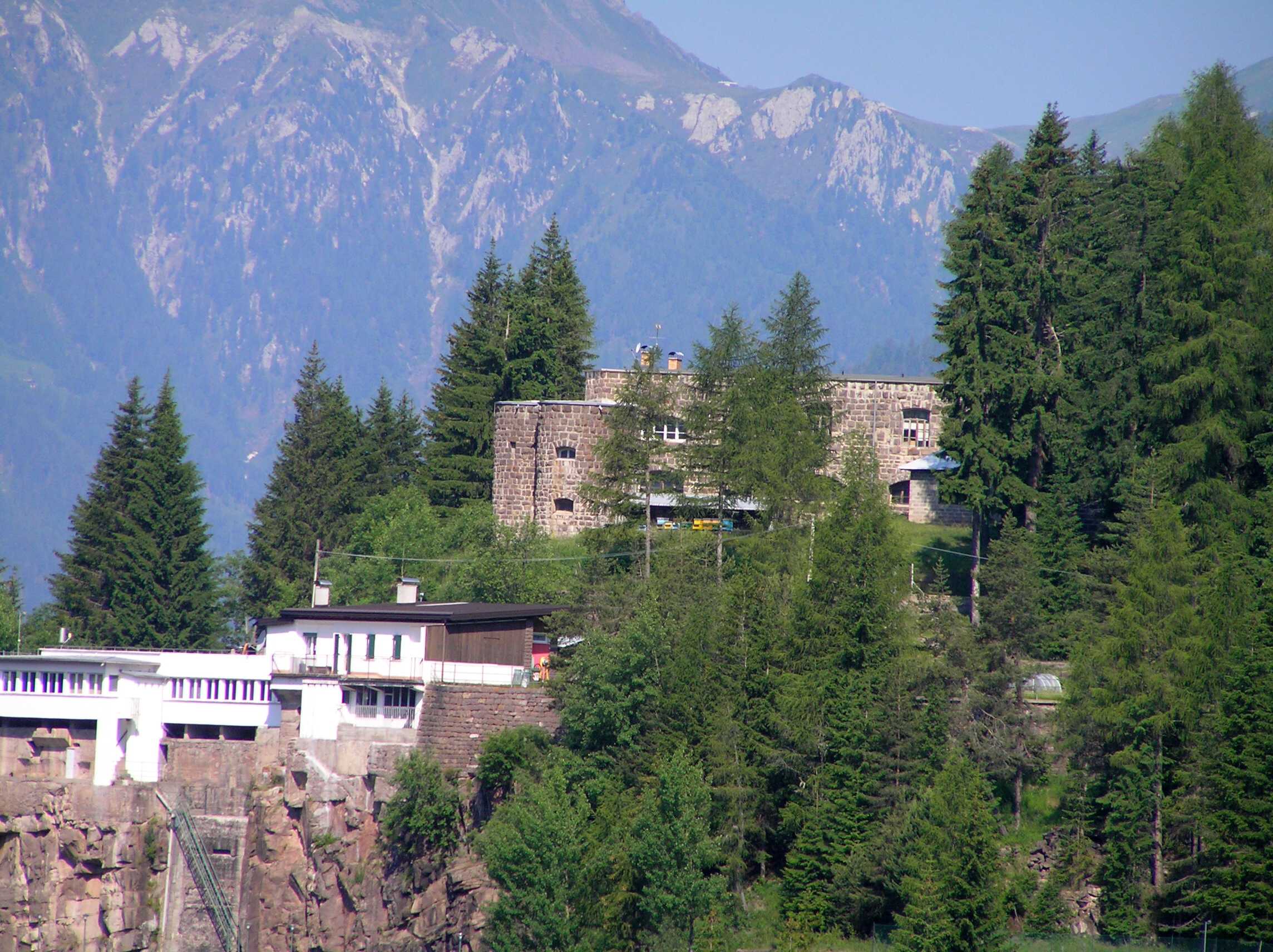
| Název: Name: | Fort Albuso | Fort Albuso |
| Originální název: Original Name: | Straßensperre Albuso | |
| Další názvy: Other Names: | Fort Buso | |
| Obec: Municipality: | Predazzo | Predazzo |
| GPS souřadnice: GPS Coordinates: | 46°18'22.74"N 11°42'02.61"E | |
| Fotografie nebo nákres: Photo or Sketch: | | |
| Druh objektu: Sort of Object: | uzávěrový fort | Barrier Fort |
| Typ objektu: Type of Object: | silniční uzávěr | Road Barrier |
| Vyšší pevnostní celek: Upper Fortress Complex: | Pevnostní uzávěr Paneveggio | Fortress Barrier Paneveggio |
| Zahájení stavby: Start of Construction: | DD.MM.1895 | |
| Dokončení stavby: Completion of Construction: | DD.MM.1896 | |
| Výzbroj: Armament: | 4x 12cm kanón M-61 | 4x 12cm Cannon M-61 |
| Posádka: Crew: | 4+134 | |
| Bojové využití: Combat Use: | DD.MM.1915-DD.MM.1918 1. světová válka | DD.MM.1915-DD.MM.1918 1st World War |
| Současný stav: Current Condition: | zachovalý | well maintained |
| Přístupnost: Accessibility: | nepřístupno | closed for public |
| Poznámka: Note: | - | - |
| Zdroje: Sources: | www.trentinograndeguerra.it | |
Fort Albuso
Fort Albuso / Straßensperre Albuso


Reklama
Join us
We believe that there are people with different interests and experiences who could contribute their knowledge and ideas. If you love military history and have experience in historical research, writing articles, editing text, moderating, creating images, graphics or videos, or simply have a desire to contribute to our unique system, you can join us and help us create content that will be interesting and beneficial to other readers.
Find out more